Inyi Maps and Layout
Nkwo Inyi Center
Oji-River Local Gorvernmnet Area,
Enugu State. Nigeria.
Former location for :
Easthern Nigeria,
Awgu District.
Former location for:
Provinces of the defunct Biafra
Oji River Provinces
Oji-River Local Gorvernmnet Area,
Enugu State. Nigeria.
Former location for :
Easthern Nigeria,
Awgu District.
Former location for:
Provinces of the defunct Biafra
Oji River Provinces
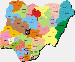
36 States of Nigeria and Enugu State Map
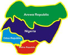
Just before the outbreak of the Nigeria/Biafra Civil War, the Provinces of the defunct Biafra were created in 1967. One of them was the Oji River Province with Headquarters at Oji River, and Oji River Urban was called a township.
With the seat of government at Oji River, Inyi began to look towards Oji River instead of towards Awgu. But the Achi County and the problem of the Orumba Merger Movement have become things of the past.
As of today, Inyi is under Oji-river LGA, in the new Enugu state, Since the last creation of states in August 27, 1991, when the administration of President Ibrahim Babangida finally acquiesced to the long agitations of Waawa people for a State they could truly call their own.
Early Inyi was an independent town and one of the affluent towns in the region of Ufuma, Awlaw and Akpugoeze. This is mainly due to the unwavering and elegant reign of Chief Maduekesi Ekwele and his forefathers in Inyi, which equally made him rich in inheritance and Popularity.
Who was also recognized as such by the British expeditionary force camped in and around Enuguabo in Ufuma, which was a recent conquest, before they invaded Inyi town during his reign in around 1910, in a surprise military attack during an Emume (Ozo title) event of Alfra Obika on an Nkwo Abia market day. In the battle of Inyi against the British, that resulted to the death of one of his son Ezeanyibara Maduekesi and the Chief took refuge in ogba ihu nabo (double-faced cave) at Alaike (a large expanse of farmland between Enugu Inyi and Awlaw) before surrendering with a Cow.
Inyi was originally placed under Okigwe District on August 23, 1918. In less than three months after, Awgu District was carved out of Okigwe District on November 4, 1918 and Inyi was placed under Awgu Native Administration, made up of Achi, Inyi and Awlaw, which many people simply called InyiAchi.
Arising from all the above in the early years, there were persistent agitations that the Enugu Area made up of Achi, Inyi and Awlaw should be constituted into a Division independent of Awgu District. Sometimes, attempts to rope in Awgu Nta, Ugwueme and one other town, in-order to enlarge the area and population of the breakaway group and improve the chances of the agitated creation.
Consequently, the people succeeded in getting the Eastern Nigeria Regional Government to give official consideration to the agitation of Enugu Area of Awgu District. An Achi County, with Headquarters at Achi, consisting of Achi, Inyi and Awlaw, and possibly including some others mentioned above.
Inyi was very happy and enthusiastic about the prospect of internal autonomy from Awgu District by belonging to a County to be located near at Achi
In the end, Inyi took a most painful decision to pull out of the Achi County bid and remain in Awgu District.
it was generally felt that Inyi merging with Orumba would probably be the best course of action.
In about the Easter period of 1959, the Government created the Achi County consisting of Achi, Awlaw and Awgu Nta. It was categorically noted that Inyi remained in Awgu District as previously. Nevertheless, the Achi County was short-lived.
Oji River Local Government Area, Enugu State, Nigeria
|
||||||||||||||||


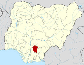
Enugu State and Oji River / Inyi Location Map

Today, Enugu State has a population of approximately 3.9 million people (2006 Census) of whom 95% are Igbo.
The State comprises three geo-political zones made up of 17 legally constituted Local Government Areas (LGAs). A further 39 Local Government Development Centres (LGDCs) were created in 2004, which have since been re-designated as Local Government Development Areas (LGDAs).
Each town in Oji River LGA is shared into Council Wards. Making up the board of councilors representing every village within Oji River, Five Council Wards is allocated to Inyi.
The five Council Wards are: (1) Enugu Inyi, (2) Alum and Akwu, (3) Umuome and Agbaliji, (4) Umuagu, and (5) Amankwo, Obune and Nkwere. Mainly based on the principles of population and contiguity of the towns.


News Highlights....
|
Inyi News and Events |
Inyi Nwa-Ocho Ucho.........................


Copyright © 2013 Inyitown.com and Inyi.co.uk - All Rights Reserved
Like our Page

